Riding the Ella Odyssey: Into the Wilds (Part 4 of 5)
(In case you missed it, here is a link to Part 1)
Between Idalgashinna and Pattipola, the track runs through its wildest stretch on the route—dense rainforest and tunnel after tunnel. (There are fourteen tunnels between Idalgashinna and the next station, Ohiya—more than between any two other stations along the line.) The track here runs along the backside of a nature preserve named after Sir Robert Wilmot-Horton, who was the Governor of Ceylon between 1831 and 1837.
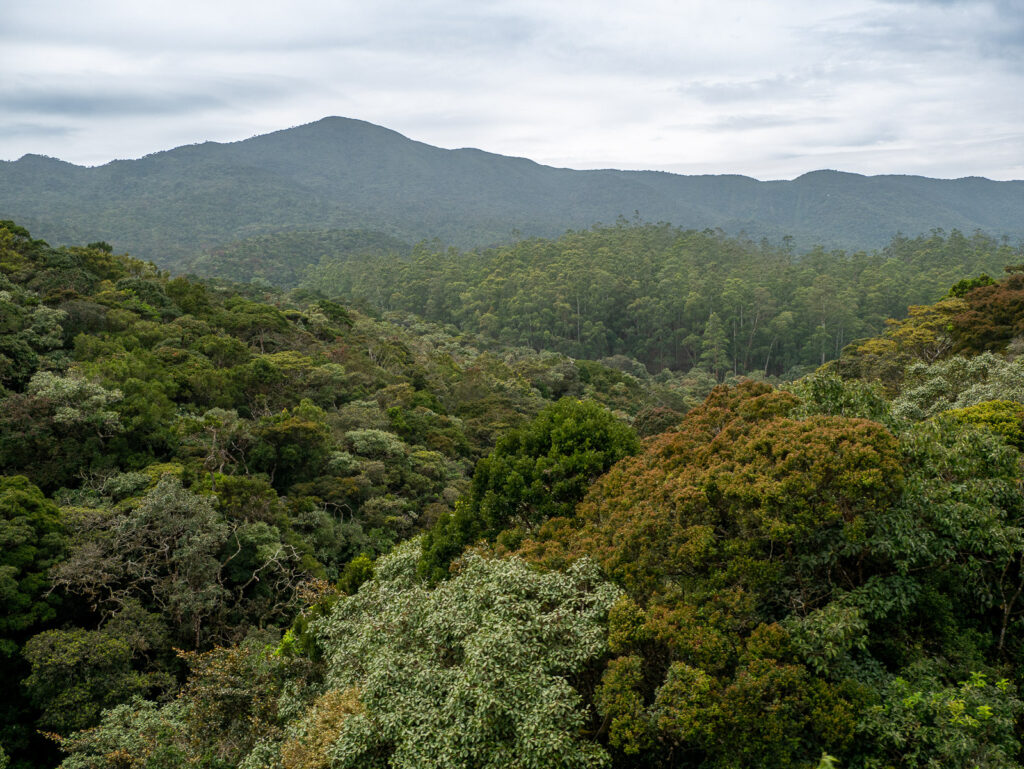
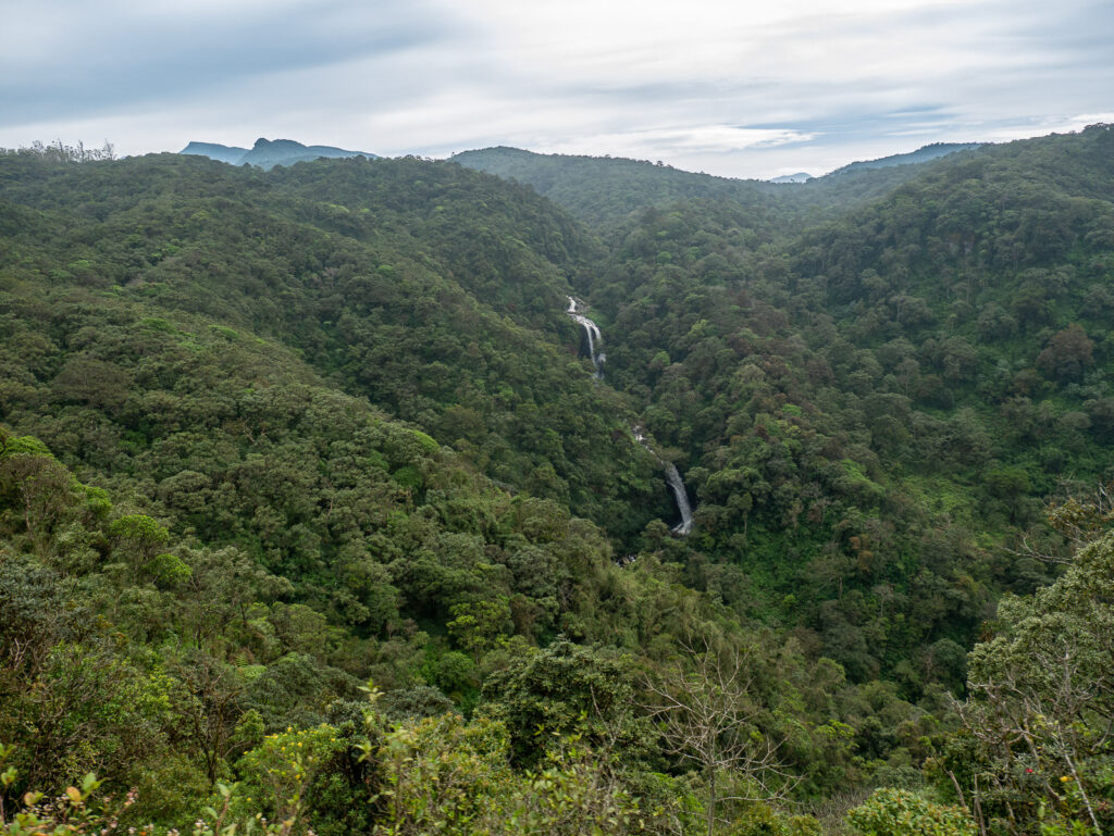
A view from the trail in Horton Plains National Park.
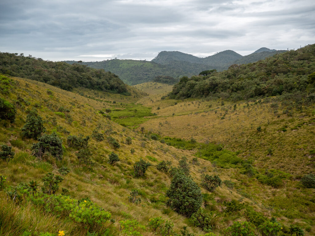
Horton Plains is Sri Lankan’s highest national park and the only one that allows you to get out of your car and hike across its wide-open grasslands. If you didn’t know better, you could easily think you were in the moors of the Scottish Highlands, except for the occasional throaty calls of purple-faced langurs. We had walked that trail a few days earlier on our way to the cliff that marks the knee-buckling view at the 4,000-foot drop-off known as World’s End.
Our path on the train was not through that part of the park, though. Here, we were in the dense forests that we had seen at the eastern edge of the plain we had hiked. Here, like in the lower parks, leopards and monkeys roam, and once even a special kind of elephant that the park’s namesake helped hunt into extinction. Because of the colder weather, the animals of Horton Plains have thicker fur, which is why the park’s purple-faced langurs are also called “bear monkeys,” because their thicker coats and beards make them resemble Grizzly Adams. Unfortunately, you’re unlikely to see them from the train or while hiking the plains—the animals here are more skittish than anywhere else we experienced in our travels and apparently avoid the open plains. The wildest and thicker rainforests of this park are closed to human beings.
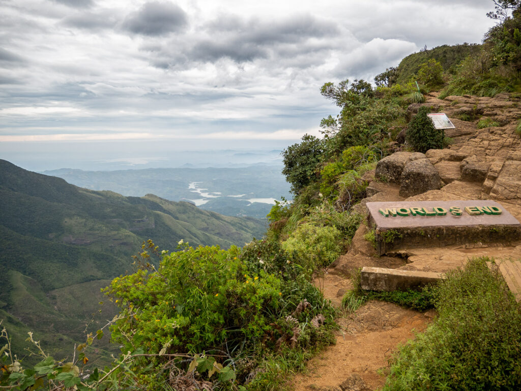
The view of the 4,000-foot drop-off of World’s End. (Don’t worry, there’s a tiny bit of barbed wire there to keep you from falling over the edge.)
Between Ohiya and Pattipola along this stretch you go through Summit Tunnel, number 18 on the line. It is the third longest tunnel on the route—as well as the highest—and is right on the border between the Central and Uva Provinces, or you could say, the Nuwara Eliya and Ella districts. It’s not uncommon for there to be vastly different weather on either side. You can enter the tunnel in bright sunshine and exit into fog and misty rain on the other.
In 1951, just twenty-seven years after the main line was extended to Badulla, this tunnel suffered a collapse when a small charge was used to dislodge a rock that was inching its way down into the tunnel. The release of that rock was followed by an avalanche of earth, stone, and mud, completely blocking the passage. Eventually, it filled with water from the northern side, making things even worse. Workers managed a fix that allowed the train to return to service, but the tunnel was significantly narrower in that one section to the point trains stopped before entering to specifically warn passengers to keep their heads, arms, and legs inside their cars. Despite this, there were still injuries and even some fatalities when the cars were overcrowded during popular Sri Pada (Adam’s Peak) pilgrimage dates. In these years, there were still some old British coaches where the doors opened out, and a few came unlatched and were torn off passing through the tunnel.
Before full repairs could be made again, the tunnel took on a reputation as being haunted. Engineers reported seeing white deer or wild boar in the engine light ahead only to arrive at the location to find nothing. Others saw red flashing lights that caused them to slow fearing a train coming the other direction, but again, there was nothing. When repairs were undertaken again, some workers feared entering, concerned there could be spiritual repercussions for violating a sacred space.
Permanent repairs were finally made in the spring of 1981 and the tunnel was returned to full use. Today plaques stand at each mouth of the tunnel commemorating those efforts and the men who undertook them.
The High Point
The highest point of a large-gauge railroad in the world.
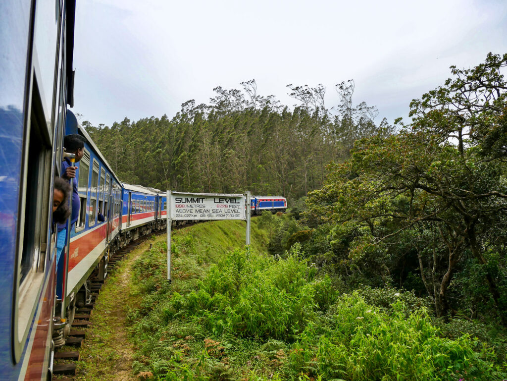
Before Pattipola (the highest station in Sri Lanka), the track reaches its zenith at 6,226 feet, which makes it the highest broad-gauge railway in the world. The summit is clearly marked with a large white sign on both sides of the track so you don’t miss it.
You won’t be long in Sri Lanka before you realize Sri Lankans love their superlatives: their greatests, their firsts, their bests, their highests, their onlys, and their mosts, whether they are accomplished by merit or design. In Nuwara Eliya, we visited a church boasting “the largest piano in Asia” to discover a relatively unremarkable pipe organ (of which, apparently, there are very few in Asia). No doubt it was old, but it was neither a piano nor very large.
Visiting various regions in Sri Lanka, you’ll get a list of things to see, which should not be confused with a list of things worth seeing (as we learned traveling around the Jaffna peninsula on a rainy day going from one “site” to the next, driving around the entire day to only visit two sites of any real interest).
Elgin Falls in the distance.
All the same, there are more than enough things worth seeing in Sri Lanka, and this train ride had already become high on my list. I have learned you need to be a bit discerning, but also take the unremarkable in stride. Travel is an adventure, after all, right? You’re on a quest. There are sure to be some rainy days and disappointments along the way. Other parts of the journey will more than make up for any disappointments, as long as you keep going.
After Pattipola, and subsequently Ambewella Station, one of the last remarkable sites of Horton Plains is Elgin Falls. Elgin Falls cascades down eighty-two feet in three distinct tiers. You only get to see it briefly from the train as you pass it in the distance, but it’s hard to miss.
Leaving the confines of Horton Plains Reserve, you will see Ambewella Dairy Farm and realize you are back in the midst of civilization, welcome or not.
Nanu Oya and Nuwara Eliya
The next stop of the Ella Odyssey is Nanu Oya Railway Station, where it felt like the rest of the world got on (more than replacing the world that got off). Nanu Oya is the closest train station to Nuwara Eliya and the doorway for most travelers to the tea country.
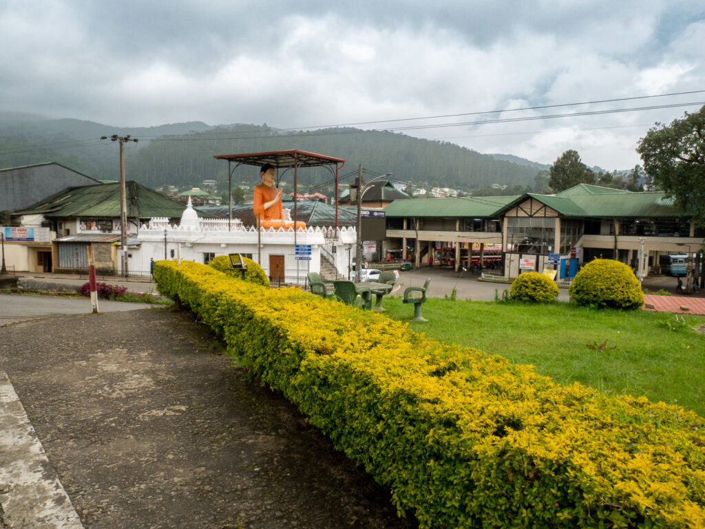
A rainy day in downtown Nuwara Eliya.
Nuwara Eliya is unique in that the town was originally built by the British and cut out of pure wilderness, which is why it is also known as “Little England.” Because of its altitude—6,129 feet above sea level—Nuwara Eliya’s climate is much like that of England (including mist-shrouded forests, rain, and fog), so the Brits established it as a home away from home for those in foreign service. They built a horse track, a golf course, a spectacular red brick post office, the expansive Victoria Park and gardens, a tennis club, and eventually they dammed a nearby stream to create Lake Gregory and stocked it with trout, as well as constructing hotels and cottages that feel plucked straight out of the English countryside.
It’s interesting to think that this “little bit of England in Sri Lanka” has become such a major tourist destination. I mean, why go to Sri Lanka to experience a “little bit of England,” right? Why come to a land of sunshine and pristine beaches to go where you need a jacket and an umbrella? But then, that is part of what makes Nuwara Eliya (which translates from Sinhala to “city of light”) a perfect place to visit on an island filled with paradoxes.
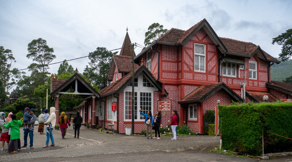
Is there a village in England missing a post office? I think we found it.
More than any other part of the island, the high country, and Nuwara Eliya in particular, is marked by British culture—from hunting lodges and spacious billiards rooms to musty pubs. This, first of all, is because the British were the first foreigners to gain access to the mountain region. Despite roughly a hundred and fifty years of Portuguese and then a hundred and fifty years of Dutch colonial rule, the hill country south of Kandy remained its own until the British negotiated Kandy’s surrender. Thus the first foreign imprint in these mountains came from the British, who went on to clear tens of thousands of acres to create plantations that would be worked by imported labor from south India and not native Sri Lankans. In many ways, it feels like a completely different country.
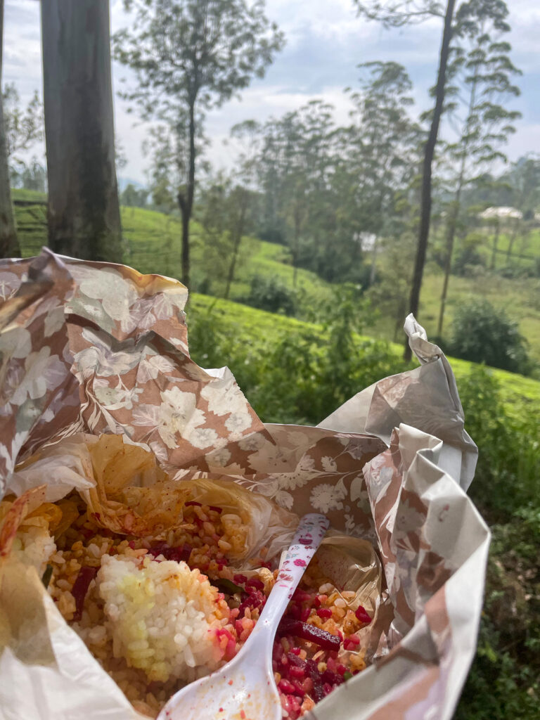
Veggie rice and curry for lunch as we passed through tea country.
The British also colonized very differently than other nations (as I learned as a Peace Corps volunteer in Africa), taking the time to build infrastructure and instill their own brand of commerce and bureaucracy, which were a good bit stickier than what was set up by countries solely intent on exploiting local resources. The British built places where they would feel comfortable living, and this generally included a train line. From Kenya to India to Sri Lanka to Hong Kong, they built like they were never going to leave, and left a great deal when they eventually turned these countries over to self-rule.
In Nanu Oya, we finally got bumped from the seats we had taken in Badulla, but simply moved to another in the center of a window a couple of seats up. The conductor who attached himself to us had ordered us a lunch of rice and curry (me veggie, Melissa chicken), which was delivered to the train at Nanu Oya Station. It was surprisingly good for take-out train fare and kept us satiated most of the way back to Colombo.
(To continue, go to Part 5: Oceans of Tea)
Recent Comments